


The Grid system
The Kriegsmarine (WWII German Navy) employed a very simple yet clever system for quickly locating, reporting and most importantly vectoring its vessels (surface ships and U-boats). This was the so called Grid system. On this page you can see how it was designed and used.
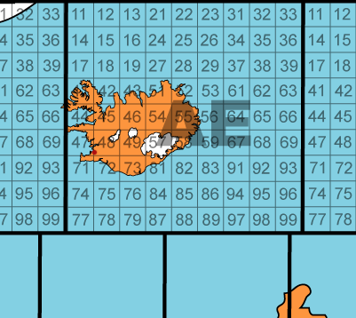
Close up of Grid AE
In the example above Reykjav�k, the capital of Iceland, is located in square AE 48 (the tiny red dot).
 Left: Quadrant 56
Each smaller grid within the main quadrants (like the "56" inside AE) was then further broken down into smaller elements to enable the Kriegsmarine to use designations like AE 5619 (shaded grid).
Reykjavík, in the map above, is located in grid AE 4874.
The entire world was mapped like that, including areas that never saw any Kriegsmarine operations.
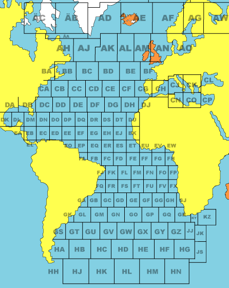
The Atlantic, Caribbean and Mediterranean shown in grid codes.